
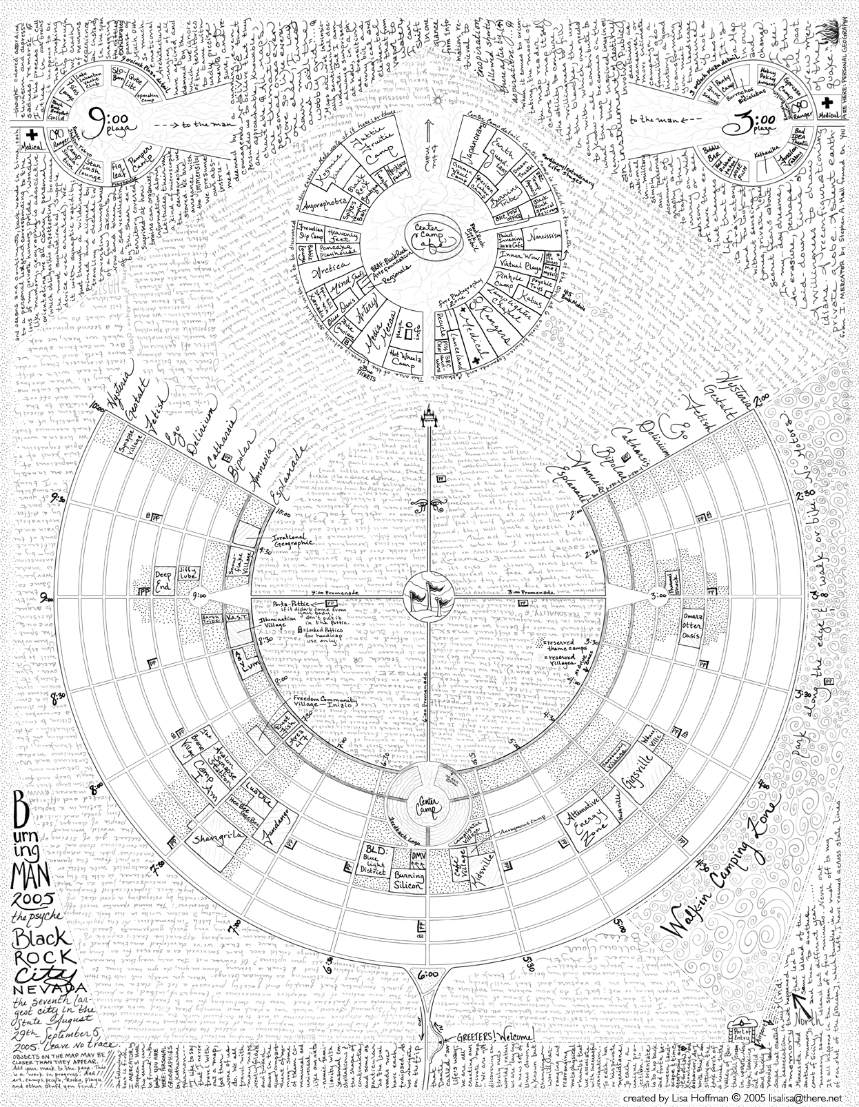
Black Rock City in hand-drawn glory. By Lisa Hoffman (lisalisa at there dot net).
Link to full-size. (Thanks, Wayne Correia!)
Reader comment: Tim Holt says,
Here's a great satellite view of burning man's land scars. An interesting companion image to that amazing hand drawn map. Link
nym says,
I've collected some Burning Man maps here, and here is a Google Maps Slideshow I made.
Sebbo says,
Tim Holt refers to Burningman's "land scars" in the Google satellite image. I think that's misleading. Judging by the amount of settlement at the site, I'd estimate that the picture was taken at this time of year–that is to say, about a week before the event started. What you're seeing is the beginning of the city, not the aftermath. I don't know if Tim meant to suggest that the site is visible year-round, but given the controversy that's sometimes swirled around questions of the event's environmental impact, I thought it would be worthwhile to set the record straight.
And, finally, a personal note: Boing Boing reader Thomas Terashima says that "Kamp Kanuckistan" at Burning Man 2005 just named me Governor General of Kanuckistan. They're calling the trophy for the group's second annual road hockey tournament the "Xeni Cup". This is totally weird and I think my brains just exploded. I don't know what to say, other than — thank you, kind Kanuckistani citizens. First gubernatorial decree: free bandwidth and beverages for all.
Thomas explains:
I am gifting a silver-plated bowl as the actual physical trophy. A group of Canadians (mostly from Calgary, Alberta) are hosting the event again this year on Thursday (September 1st) from 4 to 7 PM. Kamp Kanuckistan (representing the "stateless state" of the Free United Cartel of Kanuckistan) will be at 5:20 on Fetish.
The pronounciation of "Xeni Cup" would link it to an alternate name for the sport: Link.
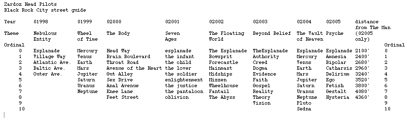
Bonus extra — a chart of 8 years of Black Rock City street names: Link.


